Orbx Announces Himalaya Mesh for MSFS
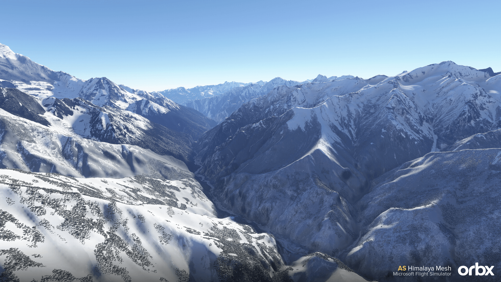
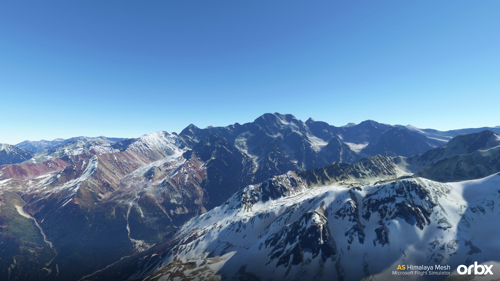
Welcome to the Himilayas! Orbx has taken to their forum and has announced Himalaya Mesh for Microsoft Flight Simulator 2020 which has been crafted from 3 different sources to bring the most accurate mesh. The Himalayas are known for their tall standing peaks and glaciers. By using 3 sources to craft this mesh, the end result is an ultra detailed terrain profile with a resolution of 10metres per pixel, providing a breathtaking experience in the area.
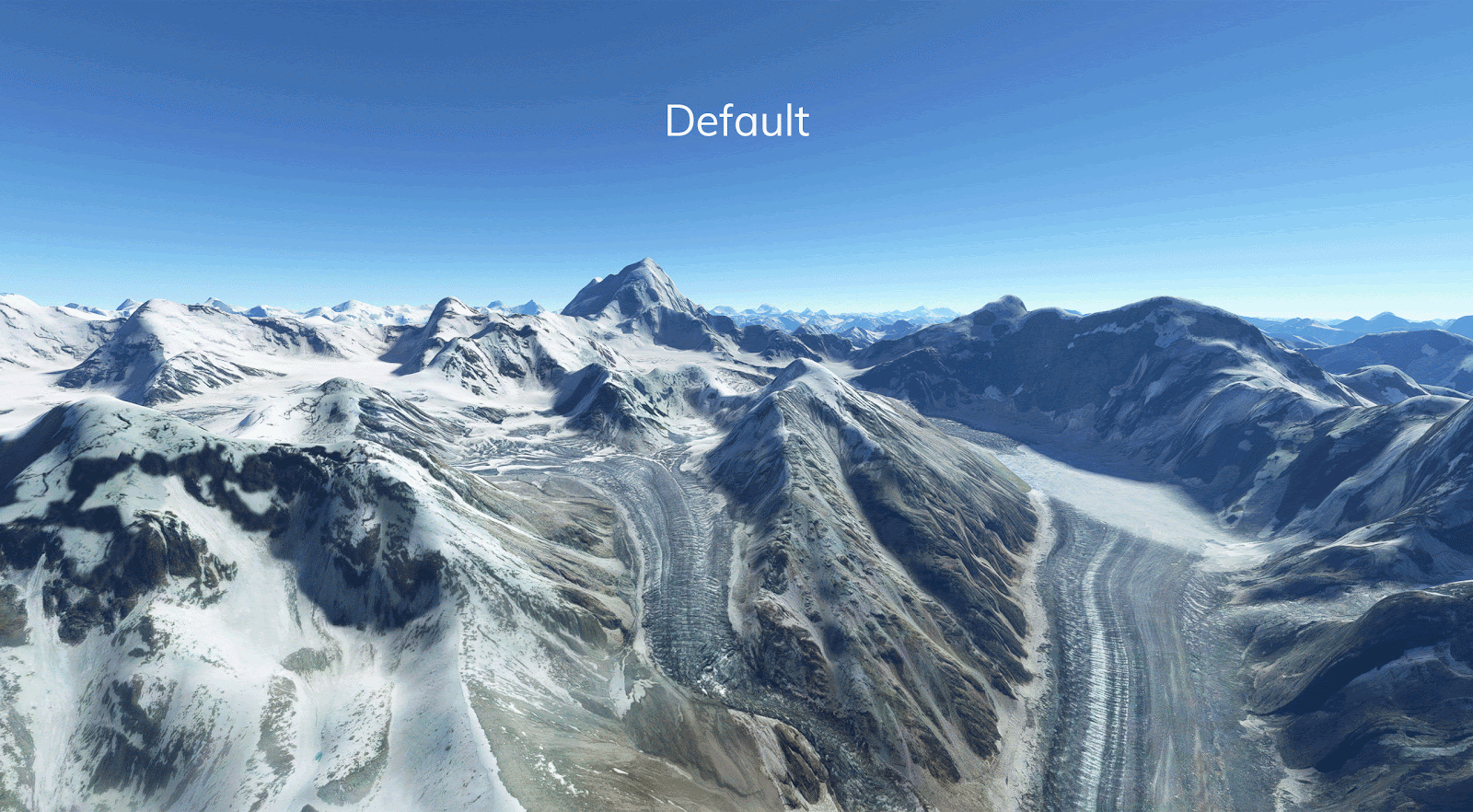
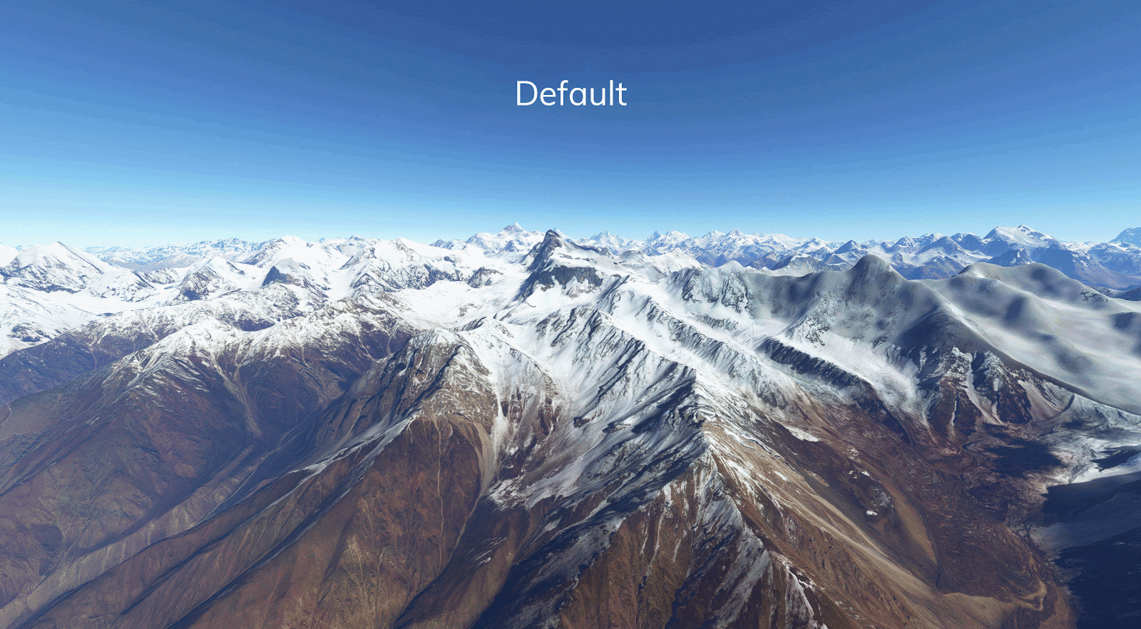

From the comparison animations, the provided uplift in terrain resolution produced visible improvements in replicating specific features of the mountain range. Like Orbx’s other MSFS meshes, the Himalaya Mesh will be 20 gigabytes in size, and is it’s own standing product with no requisites, therefore it will not affect the default mesh. No satellite imagery will be included as it is working off the base of the already excellent imagery coverage of the area. The company also advertises no performance impact, with minimal LOD (level of detail) implementation to prevent blurring and ensure there won’t be any morphing when flying through this area.

For more details and previews about the Himalaya Mesh, check out their forum post. We’ll be sure to cover the release of the mesh (and some snow cones to boot).
Share this page


COMMENT ADVISORY:
Threshold encourages informed discussion and debate - though this can only happen if all commenters remain civil when voicing their opinions.