Preview: MAPS2XPLANE Antarctica2XPlane update
MAPS2XPLANE, creator of the popular Svalbard4XPlane has released an article about a possible update to their freeware project, Antartica4XPlane.
In a post to the group's Facebook page, MAPS2XPLANE said;
I'm working on a #Antarctica4XPlane update, which will change your polar flight experience dramatically.
The article linked says;
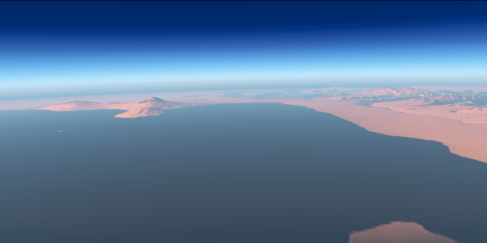
What really annoys me when flying over Antarctica4XPlane, is that the virtual horizon is so close. I feel like, that the earth is flat. X-Plane would have a solution for that, but this solution is simply not “activated” for high latitudes. To make it short, a suitable virtual horizon is in development, which will enhance your polar flight experience dramatically.
Some background information: The X-Plane landscape is tiled into 1×1 degree tiles. Such a tile has at the equator a width of about 111 km and at McMurdo Station, a X-Plane tile has a width of only 25 km. X-Plane loads 4*3 tiles and draws outside this area a low resolution mesh, encoded in the “Earth Orbit Textures”. Which results in a, more or less, nice virtual horizon. But these “Earth Orbit Textures” are missing for Antarctica.
So it seems to be an issue with the way X-Plane treats the poles on its landscape tiles.
He goes onto to say that this "fix" will be available as an update, but does not state a release date.
You can view the MAPS2XPLANE Facebook page here, the website post here, or download Antartica4XPlane from flightsim.com here.
Share this page


COMMENT ADVISORY:
Threshold encourages informed discussion and debate - though this can only happen if all commenters remain civil when voicing their opinions.